Pushing the limits of seismic resolution
By:
Mrinal Sen
UTIG
Join us for coffee beginning at 10:00 a.m.
Click for a Live Broadcast.

Abstract
Seismic resolution is dictated by the frequency and seismic wave velocity. The seismic waves see the reservoir in their entirety albeit at a very low resolution. Typically vertical resolution of seismic waves is defined to be one quarter of the wavelength based on travel time.
Beyond this, one has to make use of amplitude information. In the recent past, several attempts have been made to increase the resolution that can be achieved by seismic data. Several new field geometries have been implemented that include wide azimuth, multi-azimuth and wide angle surveys. These have resulted in the development of new processing tools for seismic data analysis.
I will review three primary developments, namely, full waveform inversion (FWI), basis pursuit inversion (BPI) and seismic fracture characterization. Unlike conventional velocity analysis tools such as tomography, FWI makes use of the complete wavefield data resulting in a much improved imaging.
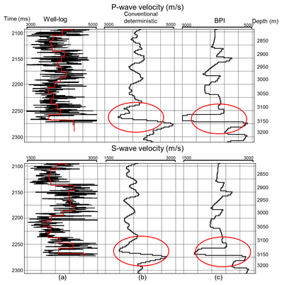
The BPI imposes a wedge-dictionary constraint in time-domain deconvolution to decipher thin layers that are below seismic resolution. Seismic fracture characterization uses rich azimuth data to estimate spatial maps of fracture density and fracture directions.


